Maps

Maps, including plat books, atlases, Sanborn maps and topographic maps.

Appleton Public Library Local History Collection

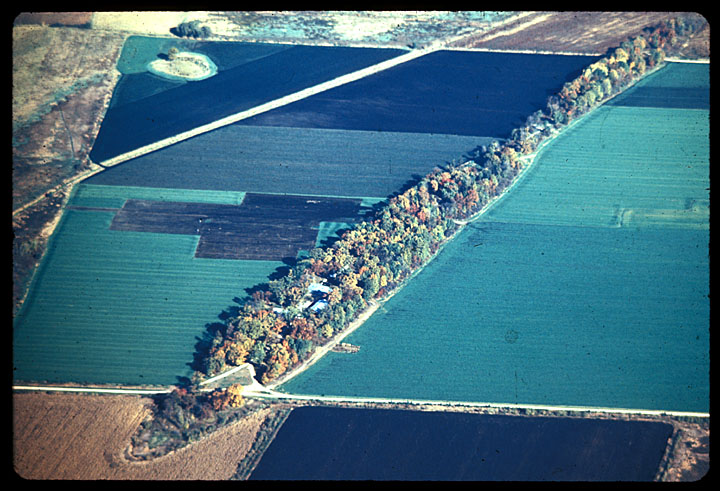
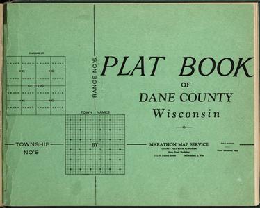
Print resources including Appleton city directories and Outagamie County plat books. Two narrative histories of the area are also included: Land of the Fox, Saga of Outagamie County (1949) and Commemorative Biographical Record of the Fox River Valley Counties of Brown, Outagamie and Winnebago (1895).

Belgian-American Research Collection

Belgian-American Research Collection

The Belgian-American Research Collection was established by the Cofrin Library, UW-Green Bay, to help preserve and make available original materials reflecting the character of the Belgian community in northeastern Wisconsin. An architectural survey was conducted to identify typical Belgian architecture including log, stone and brick houses and oral histories were recorded to document the Walloon language spoken in Brown, Door and Kewaunee Counties.

Black Earth Public Library

A collaboration between the Black Earth Historical Society and the Black Earth Public Library to provide access to photographs and other materials about the village of Black Earth, Dane County, Wisconsin. Content includes a scrapbook of Black Earth High School graduating class photos 1885-1963 and portrait photographs of past village presidents.

Brown, Door, Kewaunee, Oconto and Shawano Counties – Historical Atlases, Directories, Plat Maps and High School Yearbooks

Plat books, atlases, school yearbooks and school newspapers documenting northeastern Wisconsin, specifically Brown, Door, Kewaunee and Shawano counties. School yearbooks and newspapers included in this collection are The Okato (1922-1926), The Bay Mist (1910, 1912, 1922), The Aeroplane (1914-1921), East High Aeroplane (1924-1925), The Flashes (1912-1925), The Thistle (1908, 1913), The Crescent Beach Echoes (1909-1911, 1913, 1917, 1920, 1923), The Bugler (1918, 1922), Scroll of the Wolves (1929) and Lake Whispers (1915-1916, 1921-1925).

Chippewa Valley History

Publications including Eau Claire city directories 1880-1923, Eau Claire high school yearbooks 1900-1923, Eau Claire area histories, Wisconsin county histories and various periodicals published in Eau Claire in the early 20th century.

Clintonville Memory Project

Items pertaining to the history of Clintonville, Wisconsin including portraits of local residents photographed by J. Alva Carter in 1927, Waupaca County plat books and atlases, and photographs and a scrapbook detailing the history of Wisconsin Central Airlines and the Clintonville Municipal Airport from the 1930s through the 1970s.

Digital Sanborn Maps of Milwaukee 1894 and 1900

Two fire insurance atlases featuring detailed color maps of Milwaukee. Produced by the Sanborn Map Company, the 1894 atlas includes four volumes consisting of 450 map sheets and the 1910 atlas includes eight volumes consisting of 830 map sheets.

Ecology and Natural Resources Collection

Ecology and Natural Resources Collection

Research in ecology and natural resources conducted by University of Wisconsin faculty and staff and unique or valuable resources in these fields held by the University of Wisconsin Libraries. Sub-collections include unpublished works from the UW-Madison Arboretum, Crandon Mine and Kennecott Flambeau Mine reports, the Geology of Wisconsin Survey of 1873-1883, USGS topographic maps, technical bulletins from the Wisconsin DNR, slides and recordings of lectures by plant ecologist Virginia M. Kline and Wisconsin Bordner Survey maps.

Edgewood College History

Higher learning on the site that is now Edgewood College in Madison, Wisconsin began as early as 1881 when the Sinsinawa Dominicans established a boarding school for girls and later a junior college. Many images in this collection were taken from Phoenix from the Fire: A History of Edgewood College by Mary Paynter OP, published as part of the college’s 75th jubilee celebration in 2002.

Evansville, Wisconsin Collection

Evansville, Wisconsin Collection

The digital collection of materials from the Eager Free Public Library History Room includes Rock County, Wisconsin plat books from 1891, 1904, and 1917. Evansville was settled in 1839 and became an important stop on the Chicago & Northwestern Railway system. The digital collection includes histories and memories that give accounts of settlement and Evansville’s growth and prosperity. City Directories and photo collections of portraits, homes, and businesses are also included in the project.

Fond du Lac and Green Lake County Atlases, Directories, and Histories

This digital collection contains 13 published books and a wall map providing accessibility to early information about the City Of Berlin and Green Lake County. City and county directories list residents with their addresses and occupations and include an alphabetic list of business firms and a street and avenue guide. City information for 1892 is now easily accessible from a wall map.

Historical County Plat Maps from South Central Wisconsin and Early Madison City Directories

This digital collection of historic plat books, city directories, and atlases provides accessibility to early information about South Central Wisconsin, specifically Columbia, Dane, Portage and Wood counties. The early city directories for Madison provide helpful historical information on the early years of the state capital in addition to helping those looking for information on specific people and businesses in the area in the 1800s and early 1900s. The directories provide an alphabetical list of citizens with their addresses and occupations, a classified business directory, lists of city and county officials, churches, schools, societies, streets and wards.

Historical Maps Collection

More than 6,000 historic maps of Wisconsin and the world, dating from as early as 1513. Examples of nearly every type of traditional cartographic medium can be found, from elaborate maps of Renaissance explorations to simple outline maps.

Images of Lake Geneva

Images of Lake Geneva

Photographs and postcards depicting Lake Geneva, Wisconsin in its heyday as a summer retreat for wealthy Chicagoans. This collection also includes plat books and atlases spanning 1873-1962.

Kenosha County Digital Archive

These collections, from Community Library (Salem), Kenosha Public Library, and Kenosha County Libray System, feature photographs, documents, genealogy records, letters, and maps from Kenosha County cities, towns, and schools.

La Crosse Regional Maps Collection

Maps of the city of La Crosse, La Crosse County and surrounding region, including rail, highway, survey and topographic maps from the 1850s through the 1970s.

Manitowoc Local History Collection

Manitowoc Local History Collection

Photographs and postcards by professional photographer Herman C. Benke from the 1890s and 1900s and images by amateur photographer Frances M. Kadow from the 1920s through the 1940s. Also includes historical texts concerning Manitowoc County, plat books and plat maps, and oral history interviews recorded with area residents in the 1970s.

Marinette County Local History

Plat books of Marinette County from the years 1905, 1912 and 1920 and Marinette High School yearbooks from 1919-1924.

Milwaukee Maps

Various maps of the City of Milwaukee and the greater metro area, including population, transit and street maps, from the 1870s through the 1970s.

Milwaukee Neighborhoods – Photos and Maps 1885-1992

Images of Milwaukee neighborhoods from the Far Northwest Side to the Far South Side, providing a visual documentation of the development of the city of Milwaukee from the mid-1880s to the early 1990s. The image collection is accompanied by 12 maps of Milwaukee from the holdings of the American Geographical Society Library.

Neenah Public Library Local History Collection

Neenah Public Library Local History Collection

This collection presents the history of Neenah, Wisconsin from the 1850s to the 1950s. Includes local history texts, Neenah and Menasha city directories 1920-1939, a 1928 plat map of Winnebago County, and more than 400 photographs.

New Glarus and Green County Local History

New Glarus and Green County Local History

This collection focuses on the first 100 years of New Glarus’s history, including narratives of the settlement and early history of the village, family records from the first church in New Glarus, tax rolls of the Town of New Glarus, maps and plat books of Green County, the first yearbook of the New Glarus High School, and photographs of individuals and families, school groups, community organizations, events, street scenes, businesses, and agriculture.

Plat Maps of Racine and Kenosha Counties

The State of Wisconsin was surveyed by the federal government between 1833 and 1866 in order to divide the vast public domain into properly-sized lots that could be sold or otherwise divested to raise funds for the federal government and to encourage settlement. The work was done using the Public Land Survey System (PLSS), which divides land into six-mile square townships and one-mile square sections. Plat books and maps make use of the Public Land Survey System to represent land ownership patterns on a county-by-county basis. They are a great resource for tracing property owners and borders. The plat map for each year depicts the most updated information for the property at the time the County Register of Deeds’ records were consulted.  Such information includes the land owner, number of acres, placement of a house and sometimes other features.

Railroads of Lincoln and Marathon Counties

Photographs, maps and documents relating to the railroads of Lincoln and Marathon Counties assembled by the Central Wisconsin Digitization Project, a consortium of libraries, archives, museums and historical societies in Lincoln and Marathon counties.

Sheboygan County Historical Documents

Sheboygan County plat maps 1875-1920, local histories, centennial and homecoming souvenir booklets, and catalogs from numerous furniture manufacturers in the city of Sheboygan.

State of Wisconsin Collection

State of Wisconsin Collection

The State of Wisconsin Collection presents writings about the state of Wisconsin and unique or valuable materials that relate to its history and ongoing development. The collection includes published material as well as archival materials such as books, manuscripts, sound recordings, photographs, maps and other resources.

Upper Mississippi River Conservation Committee Collection

The Upper Mississippi River Conservation Survey Committee was established in Dubuque, IA, in 1943, originally comprised of 22 biologists from Iowa and the surrounding states of Illinois, Wisconsin, Minnesota, and Missouri. Since then, the UMRCC dropped “Survey” from their name and has grown to more than 200 resource managers working in multiple disciplines including fisheries, mussels, recreation, wildlife, water quality, vegetation, education, and law enforcement. This collection is a result of a partnership between the UMRCC and Murphy Library to provide both digital and physical access to the UMRCC Library, now housed at Murphy Library.

Walworth County Plat Map 1857

Walworth County Plat Map 1857

The Walworth County Plat Map of 1857 is the oldest and one of the most frequently used maps in the UW-Whitewater Archives. This digitized map allows users to click a township within Walworth County and view the database results for all residents and properties within that township, as documented in 1857.

Waterford Area Local History

Waterford Area Local History

The history of the Waterford area in western Racine County, Wisconsin is documented here in books, manuscripts, high school yearbooks, photographs, maps and newspapers. This digital collection is a collaboration of many Waterford area agencies including Waterford Public Library, the Village of Waterford, Waterford Area Chamber of Commerce, Waterford Union High School and the personal collections of many of the descendants of pioneer families.

Waukesha County History 1870-1920

Waukesha County History 1870-1920

The materials in this digital collection depict the industries, people and structures important to the development of Waukesha County from 1870-1920. Many of the images come from the collection of Warren S. O’Brien (1898-1988), a prolific Waukesha photographer.

Wisconsin Digital Archives

This growing collection of documents about the activities, functions and policies of Wisconsin State Government contains documents published by the Executive and Judicial branches, state government task forces, initiatives, boards, commissions, councils and special study groups. The Wisconsin Digital Archives is a collaborative effort managed by the Wisconsin Department of Public Instruction as part of the Wisconsin Document Depository Program.

Wisconsin in the Civil War

To mark the 150th anniversary of the U.S. Civil War (1861-1865), the Wisconsin Historical Society created this digital collection containing dozens of diaries, regimental histories and book-length memoirs, thousands of soldiers’ letters, hundreds of newspaper articles and more than 1,000 photographs, maps and other images.

Wisconsin Public Land Survey Records

Wisconsin Public Land Survey Records

The field notes and plat maps of the public land survey of Wisconsin are a valuable resource for original land survey information, as well as for understanding Wisconsin’s landscape history. The survey of Wisconsin was conducted between 1832 and 1866 by the federal General Land Office. This work established the township, range and section grid; the pattern upon which land ownership and land use is based.