Sanborn Fire Insurance Maps are essential resources for historic preservationists, genealogists and other researchers looking for detailed documentation of American cities and towns and how they’ve changed over time. Thanks to a generous grant from the Caxambas Foundation, the Wisconsin Historical Society is currently building a digital collection of its Sanborn maps, representing more than 250 communities across Wisconsin. Over 700 of these maps, dating from the 1880s to the 1930s, can now be discovered through Recollection Wisconsin.
POST UPDATED September 12, 2014: The Sanborn Fire Insurance Maps digitization project is now completed, with 901 maps (7,720 page images) representing 251 Wisconsin communities available online from the Wisconsin Historical Society.


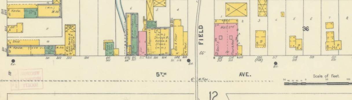
The Sanborn Map Company, established in 1867, created large-scale, meticulously detailed maps of thousands of communities large and small throughout the United States. Because the maps were originally used by insurance agents to determine fire hazards, features such as structural materials, locations of windows and doors and building functions are all carefully noted. The Sanborn Map Company’s mapmakers followed a precise set of established standards for documenting all of these features. The Library of Congress offers some helpful information for decoding the various colors, abbreviations, symbols and other elements you’ll encounter in any Sanborn map.
Thanks to the high resolution scans in the digital collection, users can zoom in on any area of a map to easily read the Sanborn surveyors’ notations. This level of detail is a boon for researchers in search of, say, the exact footprint of a specific historic building, but it’s also fascinating to simply wander through familiar cities as they looked more than a century ago.


The technical work on this extensive project has been accomplished by a team of graduate students from the University of Wisconsin-Madison School of Library and Information Studies working under Laura Farley and Jonathan Cooper of the Wisconsin Historical Society. All maps were scanned in-house with the exception of the Milwaukee Sanborn maps, which were imaged by the University of Wisconsin-Milwaukee and shared with the Society. The entire collection will be available online by the end of this year. This project, in addition to ongoing map cataloging and map digitization efforts at the Society, are supported by a generous grant from the Milwaukee-based Caxambas Foundation.
Discover all maps available online from the Wisconsin Historical Society.

You must be logged in to post a comment.